Usicayos Gold Project

Palamina has participation in 7 projects in the Puno Orogenic Gold Belt
100% interest
10,812 hectares
Department of Puno, south-eastern Peru
CLICK HERE FOR USICAYOS* NI 43-101 TECHNICAL REPORT
* Completed prior to renaming of project on July 9, 2021
Overview
The Usicayos Gold Project was acquired primarily through staking to explore a geologic environment interpreted to be similar to that of the Ollachea, La Rinconada and Crucero orogenic gold deposits. Usicayos is not subject to any NSR or onerous future payments to any vendors or optionors. Usicayos is located along the southern edge of the Puno Orogenic Gold Belt (“POGB”) with a structural environment similar to those associated with the Ollachea and La Rinconada gold deposits to the northeast and southwest.
All of these gold deposits are focused along structurally deformed east-west trending ‘jog’ zones along an otherwise NW-SE structural trend of POGB structural boundary. The mineralized surface footprint at Usicayos is second only to La Rinconada. Mineralizing controls common to orogenic gold deposits are identified throughout the POGB. Members of Palamina’s geological team were part of the exploration discovery team at Ollachea and have extensive experience in the POGB.

Infrastructure
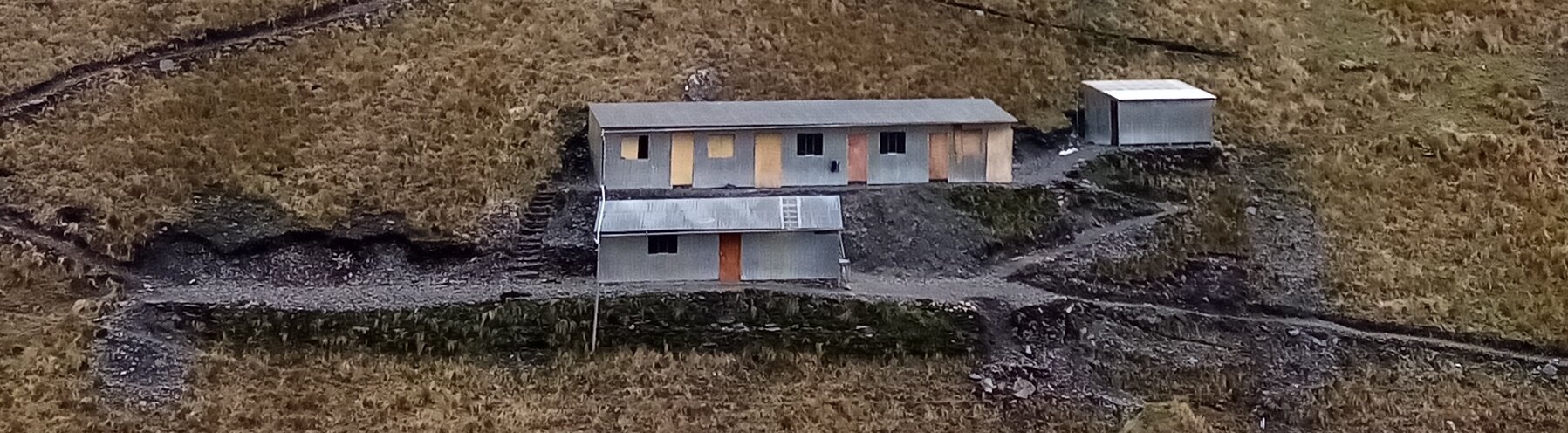
The Usicayos Gold Project is located north of the town of Usicayos which is a 4 hour drive and 150 km north west of the city of Juliaca via paved and gravel roads. Juliaca is a local economic hub which hosts a domestic airport as well as many services which can support exploration at Usicayos. Palamina has a field office / core storage facility in Juliaca. Palamina’s field once in Juliaca is located 800m from Certimin’s prepratory assay lab.
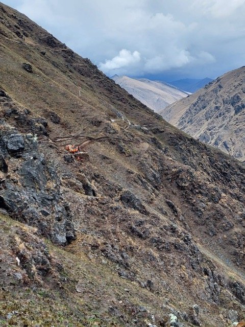
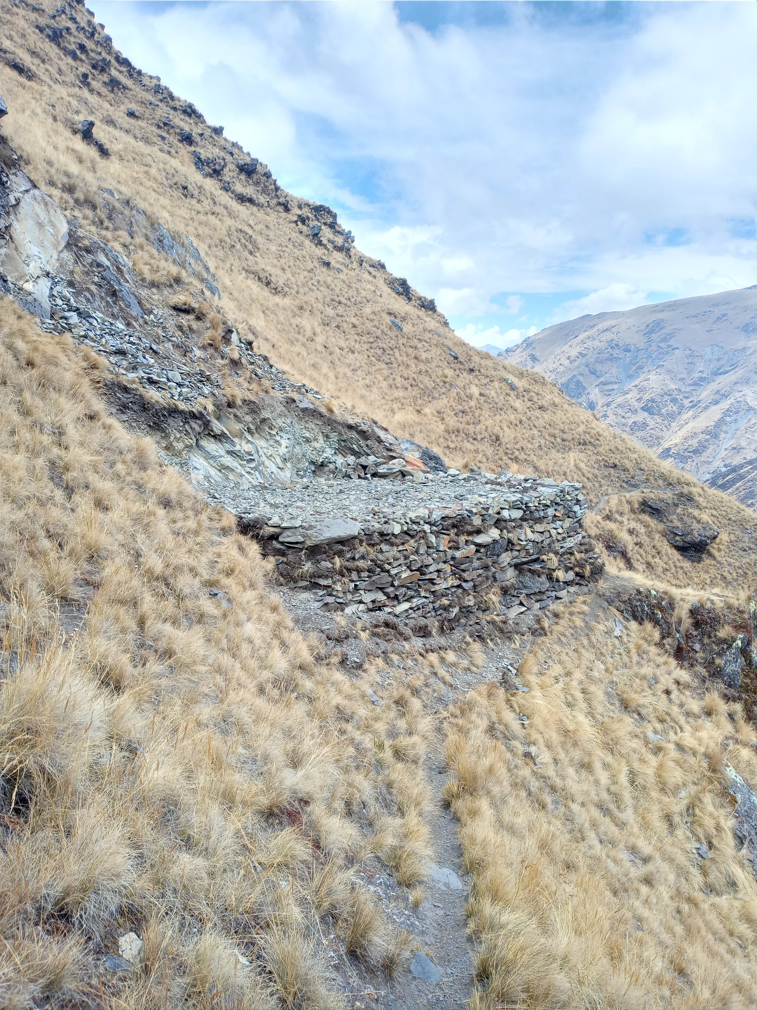
Elevations at Usicayos range from 2,800 to 4,700 metres. Access to the project is along dirt roads from the towns of Usicayos and Coasa to several points within the claim block. From these points, exploration is undertaken on foot or by horse along river valleys or footpaths to access mineralized targets. Due to the elevation, rock exposure is generally excellent as the property sits above the tree line with sharp rocky ridges at the highest elevations, which give way to high alluvial terraces and narrow canyons at lower elevations.
Geology
The Usicayos property captures a 22 km long section of deformation corridor hosting numerous discrete shear zones. These are believed to be intimately associated with the extension of regional shear structures controlling gold mineralization at the Crucero gold project located 4.5 km south of the Usicayos Project’s south-eastern boundary. At Usicayos, Palamina has identified 3 significant gold zones. From west to east the Sol de Oro, Cayos & Veta zones are know areas of gold mineralization within the same SW NE trend. To date Palamina has completed 6 diamond drill holes in the Veta Zone
Lithology, structure, sulphide mineralization and intrusive bodies similar to those identified at Ollachea have been identified at Usicayos Shear zones are concentrated along relatively weak horizons, especially along organic-rich black shales principally of the Late-Silurian/Early Devonian Ananea Formation.
Sol de Oro, Cayos & Veta discovery zones:
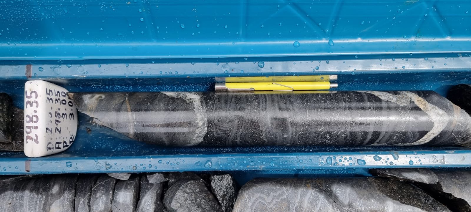
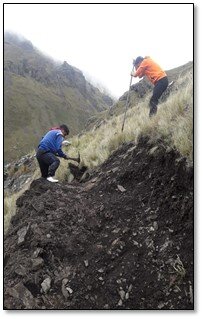
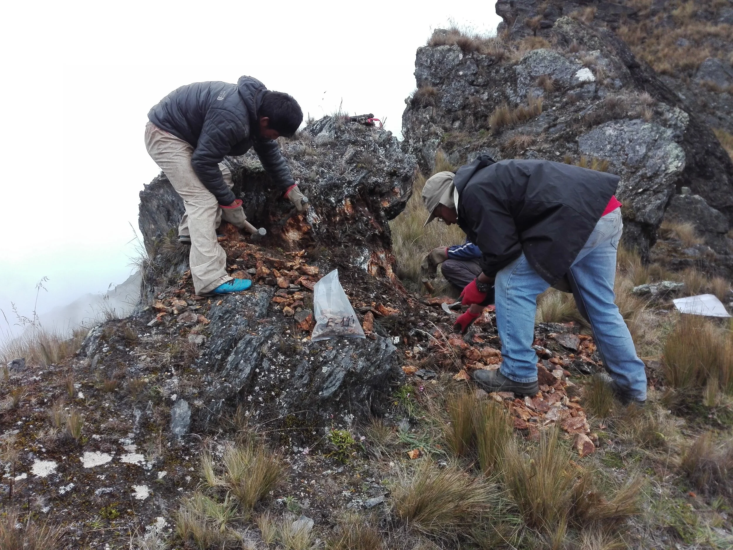
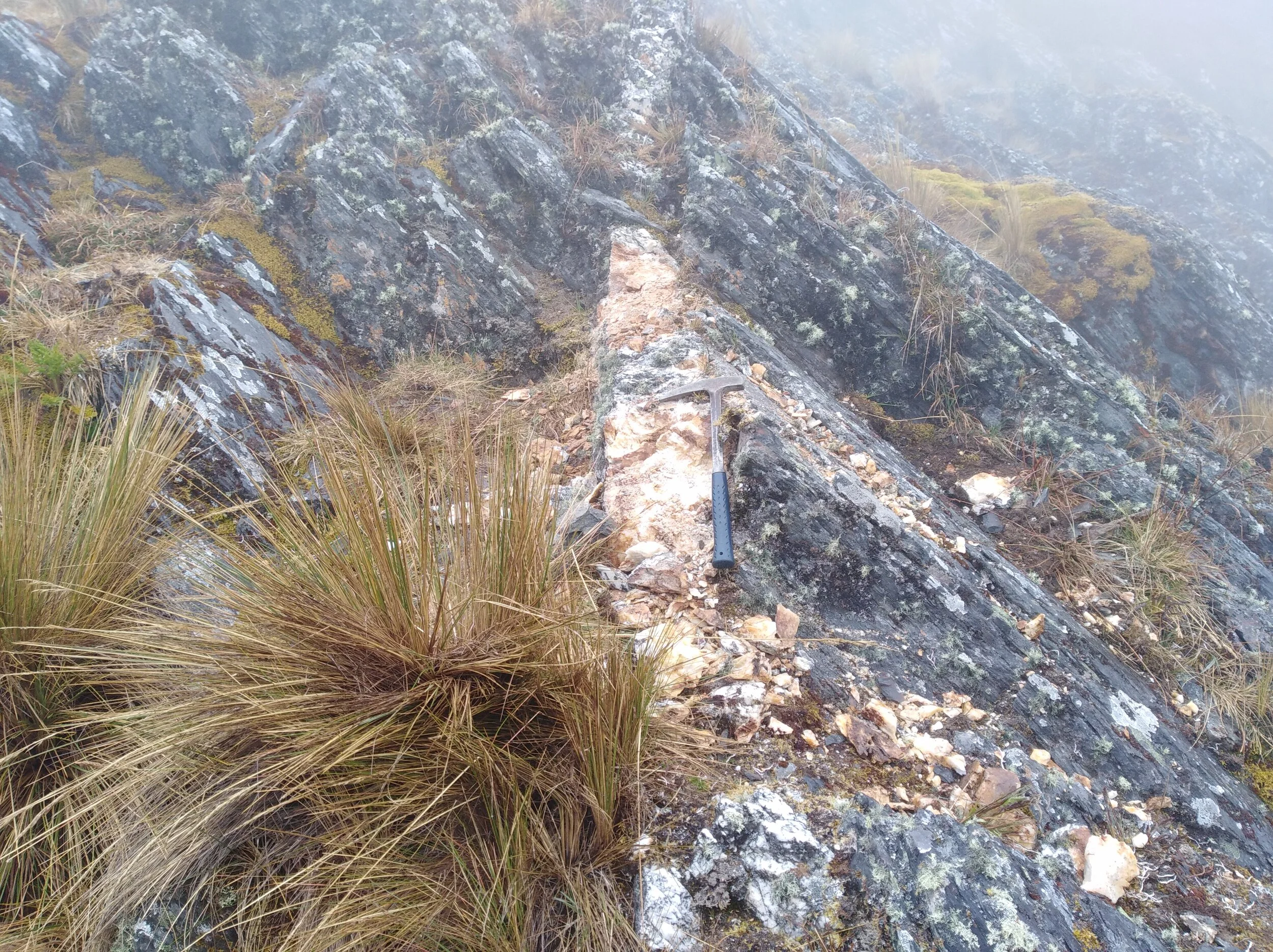
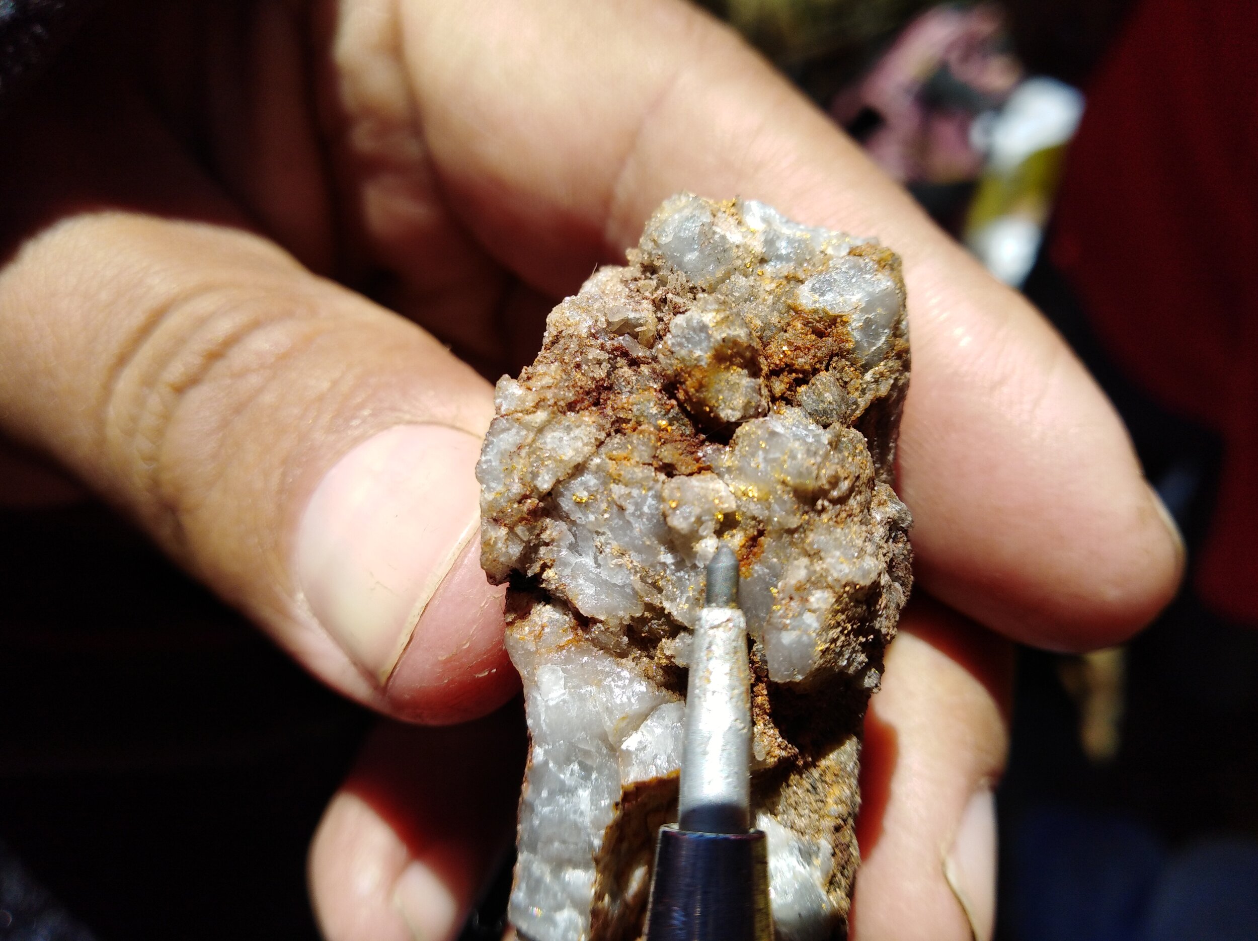
Geological mapping, surface and channel sampling has resulted in the discovery of a 4.5 km by 1.5 km anomalous gold trend made up of the Sol de Oro, Cayos and Veta gold zones. Multiple visible native-gold hosted in shale horizons have now been discovered by prospecting in newly defined areas where limited informal mining has taken place.

Select sampling results from the Cayos Zone to the North east have returned up to 30.5 g/t Au over 3m in a continuous channel sample. In the Veta Zone select sampling has returned up to 620 g/t Au (19.9 oz/t Au) from an outcropping quartz vein and continuous channel sampling has returned up to 90.3 g/t Au over 1.3m. These results, along with heliborne geophysical survey work and a comprehensive structural study completed have played an important role in defining these 3 gold zones as priority drill target areas.
The two most recent campaigns of mapping and rock sampling focused on the newly acquired Sol de Oro (“SDO”) area, approximately 1.7 to 3 km’s southwest of the zone of earlier drilling in the Veta Zone. Reconnaissance mapping and sampling followed a series of mineralized deformation zones approximately 2.2 km to the east and northeast. Host rocks are variably metamorphosed Middle Paleozoic Ananea siltstones and shales intruded by thin sills of fine-grained diorite. Airborne magnetic surveys suggest the area is underlain at depth by a younger, larger intrusive body with a similar orientation.
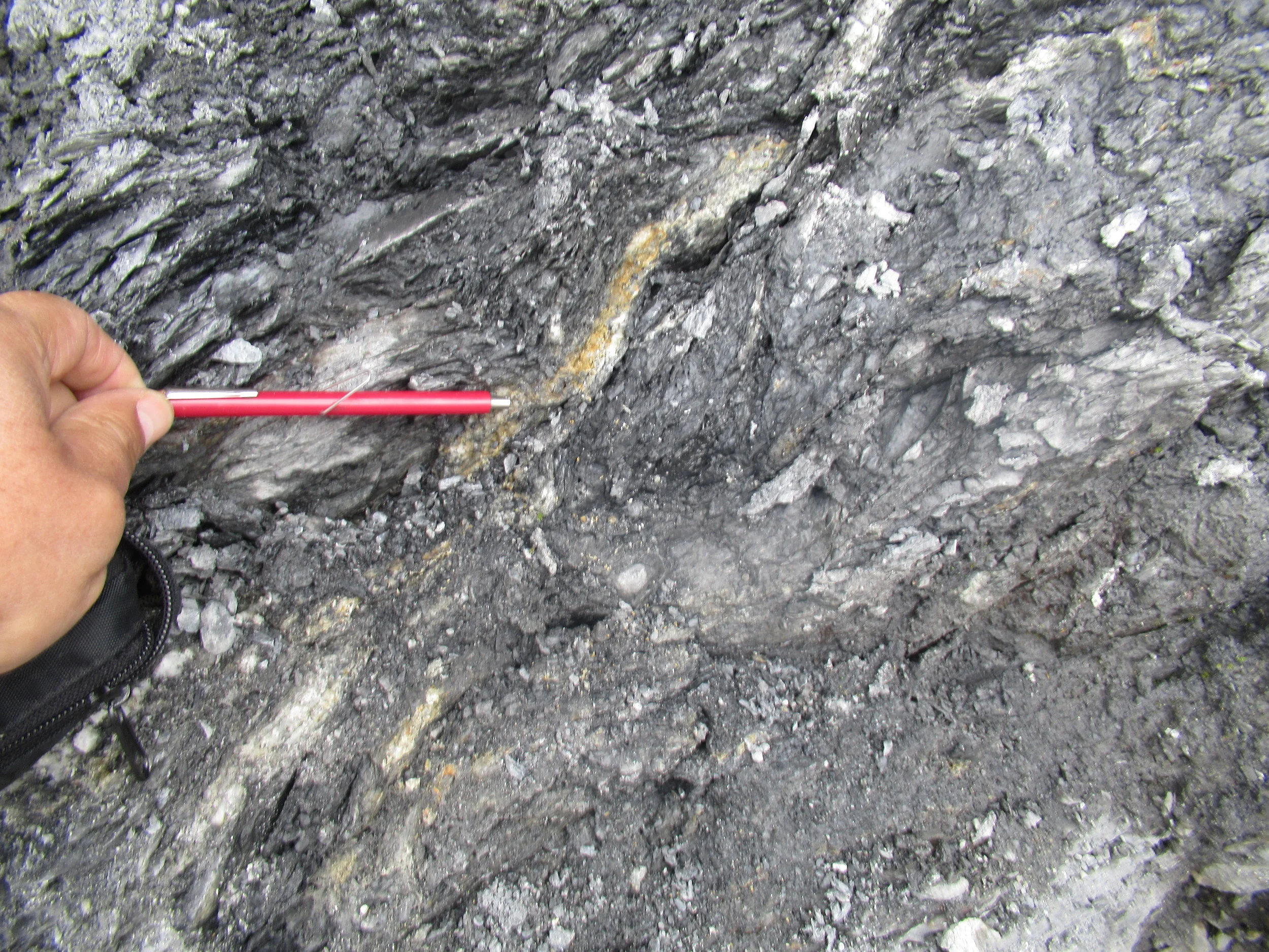
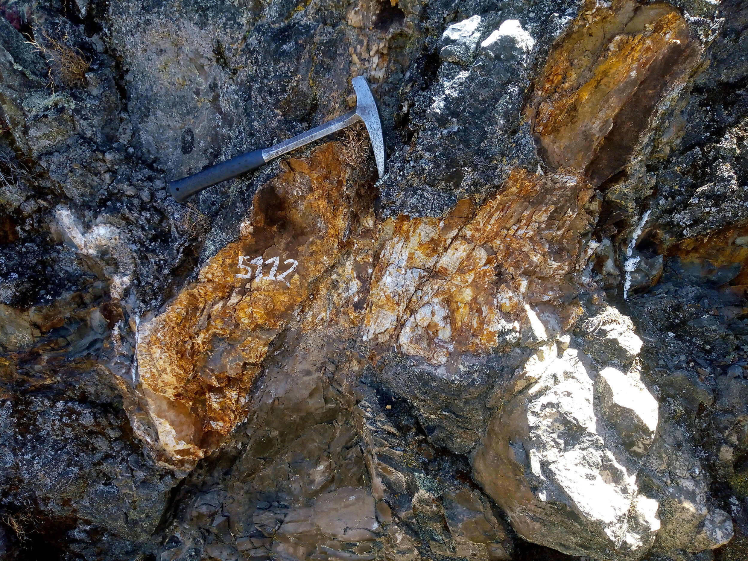
Within the corridors of focused deformation mineralization occurs within thin, white to grey quartz veins containing pyrite, arsenopyrite and pyrrhotite. These veins can be either thin grey veins that are folded or boudinage and weakly folded or straight extensional veins of white quartz with pyrite. Visible gold was observed in both types and within boxworks in areas of weathering. Vein and veinlet frequencies range from 2 to 10m ; best mineralization occurs in grey quartz within “mantos”, parallel to bedding/schistosity, while cross-cutting veins are barren.
At Usicayos each of the major gold mineralized zones is hosted in Ananea Formation shales and mudstones and controlled by shear zones in a flower structure pattern developed by regional thrusting. The structure at the SDO Zone is currently the widest section identified on the property, with an approximate 1.5 km width versus the 0.25 km width drill tested at the Veta Zone. Gold mineralization is found on both sides of the structure and mineralization dips steeply towards the centre. Four mineralized gold systems have been identified at SDO that are structurally well defined and continuous at surface, three at SDO South and one at SDO north.

In 2022 sampling from SDO South returned up to 200 g/t gold over 0.9m from a chip sample, 3.4 g/t Au over 14.0 m from surface channel sampling and 23 g/t Au over 0.7 m from underground workings. SDO North returned up to 46.2 g/t Au from a rock sample, 5.1 g/t Au over 4.0m from surface channel sampling and 15.4 g/t Au over 2.7m from underground workings. SDO South West returned up to 37.5 g/t Au over 1.8m and 1.4 g/t Au over 18.8m from surface channel sampling. SDO East returned up to 18.9 g/t Au over 2m from surface channel sampling.
All 3 gold zones are associated with regional NNE-SSW broad radiometric and magnetic trends where the Cayos, Veta and Veta NE trend occur along the margin of an intrusive. These 3 zones are located within magnetic highs at the intersection of interpreted regional scale shear zones and SE to NE fault structures. Palamina continues to investigate the potential that Usicayos may host an intrusive related gold deposit as a portion of the gold mineralization identified to date is centered around an intrusive.

In 2022/2023 Palamina completed 6 diamond drill holes over a total of 2,081 metres (‘m’) in the Veta Zone. Drilling tested below the entire 800 metre long gold-bearing quartz vein system exposed at surface where two of five holes returned visible gold intercepts. A total of 6 diamond drill holes were completed; Drill hole VE-01-2021 returned 1m @ 1.26 g/t Au, VE-02-2021 1m @ 3.09 g/t Au (visible gold in intercept), VE-03-2021 24m @ 0.5 g/t Au, VE-04-2021 11m @ 0.8 g/t Au, VE-05-2022 4m @ 0.67 g/t Au (visible gold in intercept) and VE-06-2022 11m @ 0.68 g/t Au.
In August of 2024 Palamina resumed drilling in the Sol de Oro zone where a total, 2,306 metres in nine drillholes were completed by the end of November 2024. Palamina’s drilling program tested the 4 main SDO zones. Results from drilling were returned as follows:

Palamina’s inaugural drill program in the Sol de Oro zone targeted the north and south ends of an interpreted flower structure, as well as the eastern zone between them. Drilling at SDO East revealed extensive mineralization, with gold grades increasing toward the north. Drill holes US124-02 and US124-03 successfully intercepted Manto 1, but did not reach Manto 2 due to drilling challenges that led to their abandonment before reaching the target depth. Mantos 3 and 4 remain to be drill tested.
At SDO S, drillhole USI24-04 intercepted a mineralized blind microdiorite intrusive 113 metres down hole, with gold mineralization associated with pyrite and pyrrhotite, occurring as disseminations and in massive sulfide veinlets. USI24-05 is a scissor hole drilled from the same platform. Mineralization at SDO S dips to the north on the south end of the flower structure. Both drillholes intercepted multiple visible gold zones associated with pyrite and pyrrhotite.
At SDO N drillholes USI24-07 & USI24-08 both intercepted broad zones of gold mineralization above the Corihausi fault, a gently south-dipping shear zone at the north end of the flower structure. Mineralization remains open to the south and to the east where multiple gold anomalies have been identified in previous surface sampling programs. Gold mineralization at SDO N occurs in a metasedimentary sequence consisting principally of carbonaceous shale and sandstone, with a well-developed penetrative foliation dipping to the south.

Location of 9 drillholes testing 4 zones at SDO & section lines A & B in Figures 1, 2 on TMI magnetic map
At the south end of the flower structure shown, drillholes USI24-06 and USI24-09 have established that pyrite and pyrrhotite likely account for the WSW-ENE magnetic trend extending over 1km from the SDO W zone to the SDO S zone. While assay results for drillhole USI24-06 did not return economic grades, the hole visually confirmed the presence of the same pyrrhotite-pyrite-chalcopyrite-arsenopyrite assemblage as seen in USI2404. Results for USI24-09 are pending.

Drilling is expected to resume early in the second quarter of 2025 at the end of the rainy season. Palamina plans further drilling in the SDO N zone to continue to test the 500 x 400 metre geochemical anomaly, test the intersection of SDO N and SDO S at depth and to test the northern extension of the SDO E zone, north of USI24-03.